20
\$\begingroup\$

In the past, I've used tools like SunCalc and The Photographer's Ephemeris to plan landscape shots in advance, based on where the sun and moon rise and set. Is there a similar tool that can overlay the angular field of view of a lens?

I want to drop a marker at the camera position, and either display the angle of a field of view that I select on the map, or draw a field of view based on an angle I specify. Either one would be fine. Basically an angular version of the "ruler" tool in Google Maps and Google Earth.

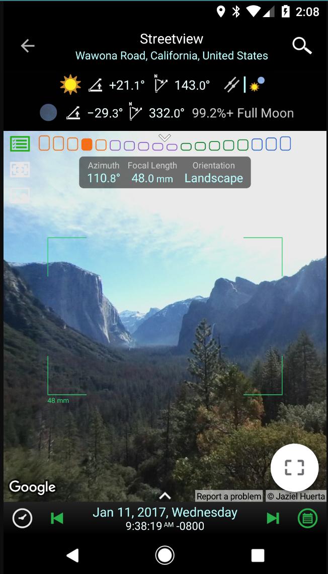
enter image description here

\$\endgroup\$
3
  • 1
    \$\begingroup\$ Good question. There is a number of ways this can be done in 2D as well as 3D in a GIS software and utilizing digital elevation models and aerial imagery but I am not aware of an out-of-the-box tool for Google Maps, Bing Maps etc. You could try posting this in the GIS Stack Exchange site. \$\endgroup\$ Commented Apr 12, 2012 at 16:55
  • 1
    \$\begingroup\$ Yeah, I should have said "ArcMap need not apply." :-) Will consider asking on GIS depending on the answers here. \$\endgroup\$
    – coneslayer
    Commented Apr 12, 2012 at 17:05
  • 1
    \$\begingroup\$ Meta: This is the way to suggest that other SE sites may also be useful, not migrations without discussion with the OP that we often fall into. \$\endgroup\$
    – Reid
    Commented Apr 15, 2012 at 19:44

7 Answers 7

12
\$\begingroup\$

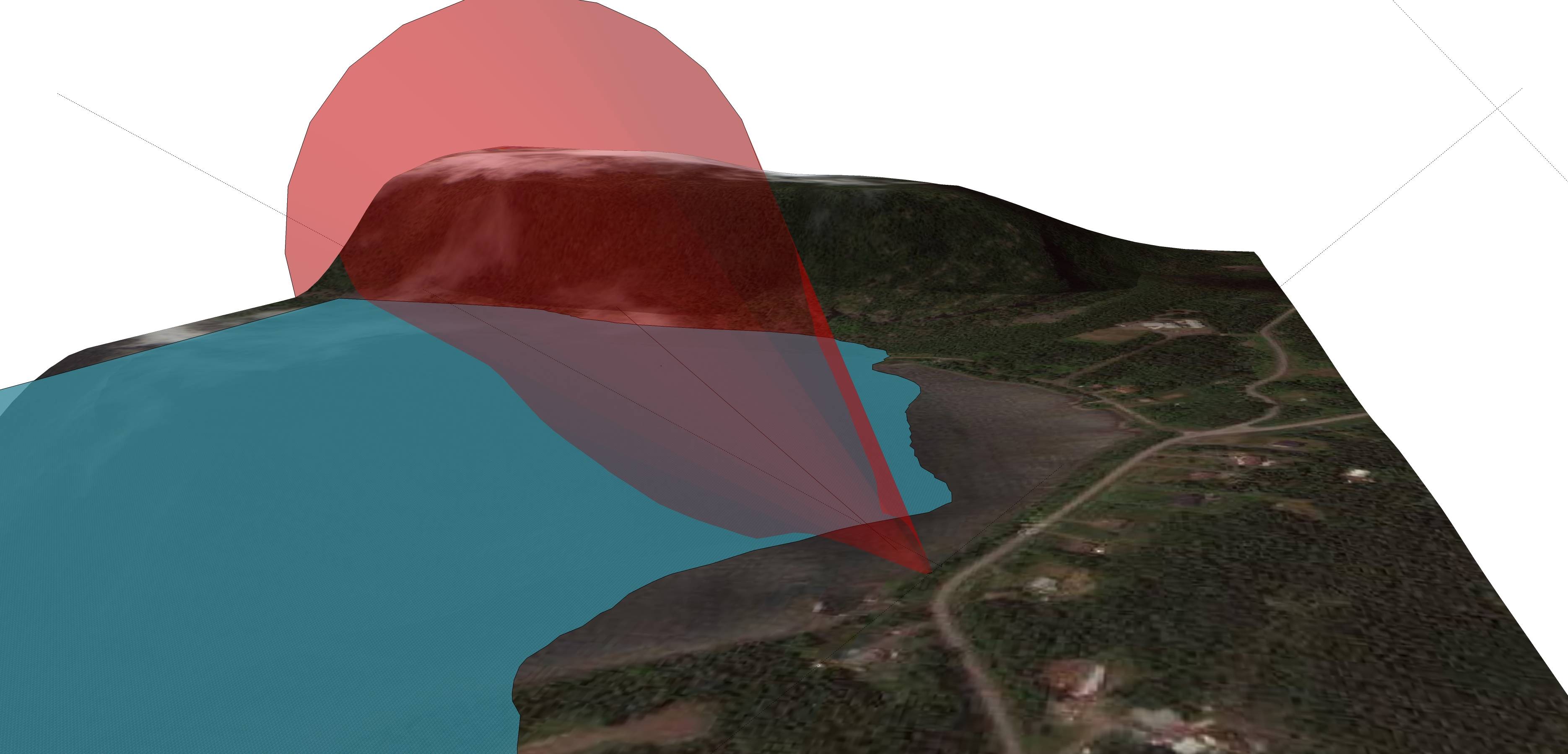
Google Sketchup 8 (a free 3D modelling software) enables users (being a Google product) to "legally" add Google maps imagery and terrain to 3D models. You can then use the protractor tool to measure and draw your line of sight and an angle of view. In fact you can easily draw a 3D cone as well that will enable you to analyze the angle of view in 3D. In addition, SketchUp can also add shadows for any specific geographical location and enables you to toggle the shadows by date of year and time of day. You can easily model buildings into the terrain by tracing building footprints in the satellite imagery and very easily extruding them to any height - this is particularly useful if you want to be able to analyze how shadows are cast from any buildings that might exist in a particular location.

Many people can be discouraged just by this being a 3D modelling environment but I can assure you that although you can create very complex models it is very easy to use. Take a look at this video which explains how to create contours in SketchUp from google earth terrain. Contours aside, in the begging the video shows how to create a 3D terrain with google earth imagery draped over it in less than 30 seconds.

The best part is that your locations are geographically referenced so modelling with shadows is geographically accurate. You can also publish you model for viewing in Google maps/earth and it will display in the correct location.

There are a lot of how to videos on YouTube so finding out how to work with the various tools is easy. It is also a very fun software to use.

If you want to take this a step further, you could use a 3D GIS and high resolution terrain models/aerial imagery but this will not longer be free nor easy.

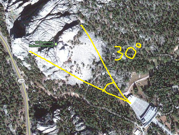
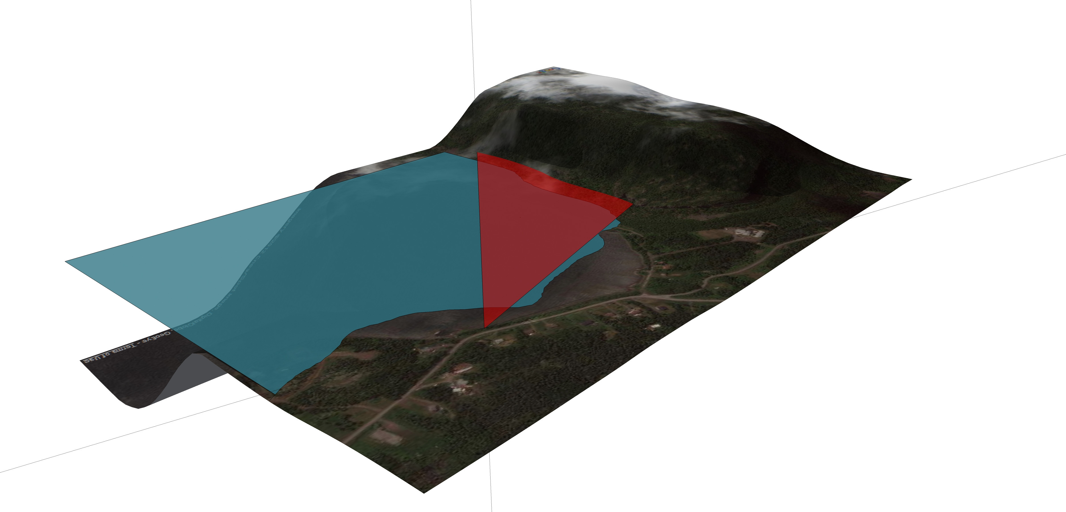
EDIT: Here is a quick 30 degree angle of view model at one of my locations. (shadows are set at october 8, 4:20 PM - you can see them on the hill across the bay)

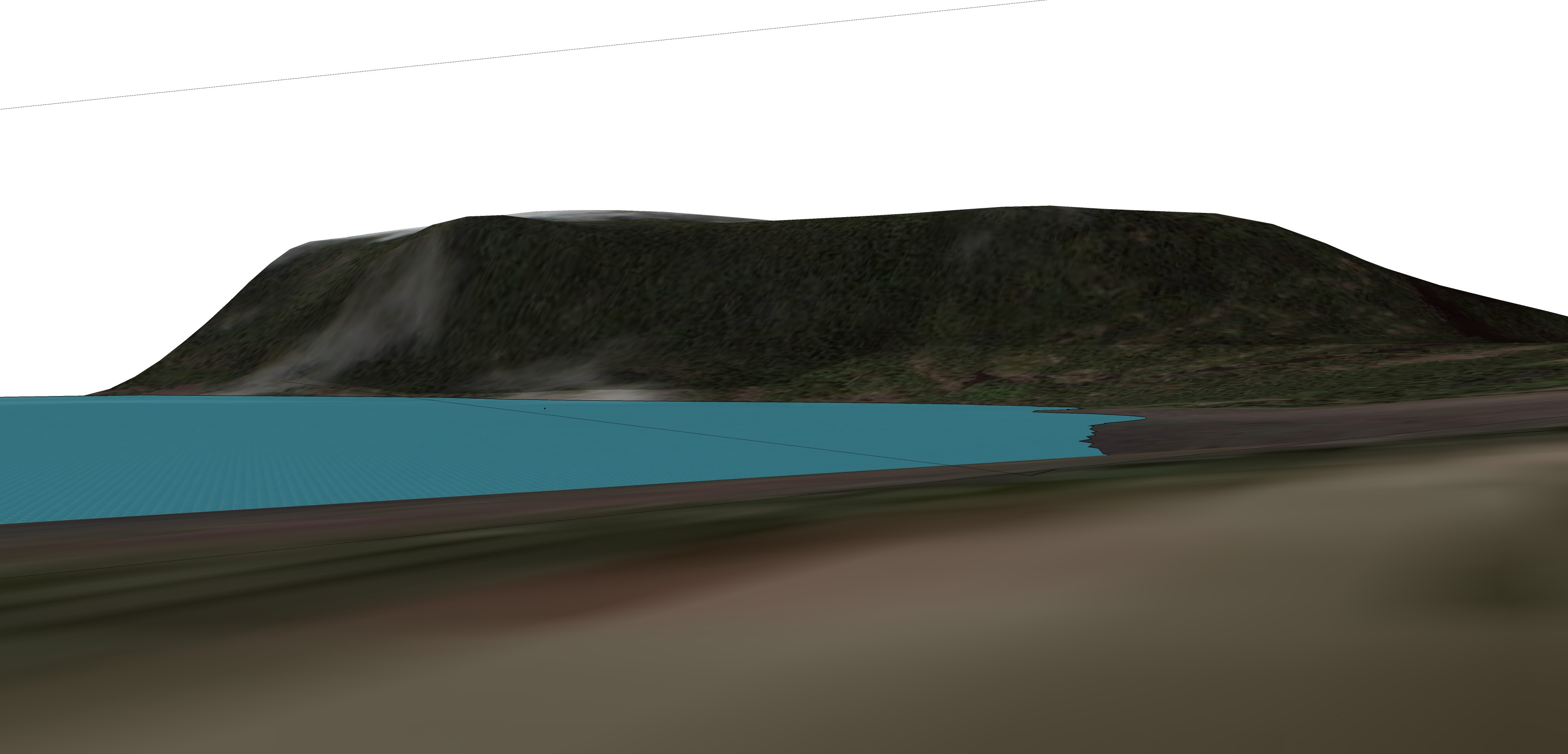
EDIT 2: I just looked at the tools in more detail and there is a LOOK AROUND TOOL which allows you to click anywhere on the surface and look around as well as a FIELD OF VIEW tool that does just what it says... enter image description here using cone: enter image description here With LOOK AROUND observer using a FIELD OF VIEW TOOL @ 30 degrees: enter image description here
\$\endgroup\$
3
  • \$\begingroup\$ Thanks, I've been meaning to try Sketchup for other things (like modeling my house) but hadn't thought of it for this. Sounds like I should check it out. \$\endgroup\$
    – coneslayer
    Commented Apr 12, 2012 at 17:45
  • \$\begingroup\$ Wow, I used Sketchup a few years ago for some simple 3d modelling, I had no idea you could now generate shadows and get access to terrain data! \$\endgroup\$
    – SoftMemes
    Commented Apr 12, 2012 at 18:08
  • 1
    \$\begingroup\$ the functionality to add imagery and terrain was greatly improved in version 8. I added a quick 30degree angle of view at one of my locations. Also added the lake surface and made it a bit transparent. \$\endgroup\$ Commented Apr 12, 2012 at 18:11
9
+250
\$\begingroup\$

I also needed something like this and created a simple (2D only) tool based on Google maps. It might be helpful to someone, so I put it online. Feel free to use it here: http://pictureprep.appspot.com/

\$\endgroup\$
1
  • 1
    \$\begingroup\$ This is a great tool--exactly what I was looking for (and more)! This answer will receive a bounty as a small token of gratitude (I have to wait 24 hours before awarding it.) \$\endgroup\$
    – coneslayer
    Commented May 2, 2014 at 15:08
3
\$\begingroup\$

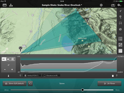
The authors of The Photographer's Ephemeris have released an iPad app that allows visualization of lens field-of-view:

The Photograhper's Transit

(Now I just need an iPad.)

enter image description here

\$\endgroup\$
3
\$\begingroup\$

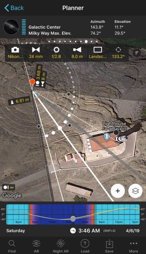
Photopills app does exactly this.

See their homepage here.

enter image description here

The Software is available for iPhone and Android devices.

Field of View Map Function

\$\endgroup\$
2
  • \$\begingroup\$ Can you add some explanation how to do this with photopills? I know it has the field of view calculator but I can't find an option to visualize the cone on the map. \$\endgroup\$
    – luator
    Commented Oct 19, 2022 at 8:05
  • \$\begingroup\$ Found it: photopills.com/blog/update-fov-dof-map \$\endgroup\$
    – luator
    Commented Oct 19, 2022 at 8:21
2
\$\begingroup\$

You could use an overlay image of a compass on google maps or you could use a software like this.

Future links:

  1. Map area calculator tools
  2. Screen Protractor is an paid alternative. ~30$
\$\endgroup\$
1
  • \$\begingroup\$ Thanks, these are handy and good to know about. Ideally, I'd like something a little more specialized than the compass (so I don't have to count off ticks, etc.). I'll have to check out Screen Protractor. \$\endgroup\$
    – coneslayer
    Commented Apr 12, 2012 at 17:09
0
\$\begingroup\$

The app you are looking for is "PLANIT" you can set a pin on a google map, set camera location, pick lens angle of view, set focus distance, aperture and even see the depth of field.

Screenshot

It is available for iPhone and Android.

Homepage of the Software

\$\endgroup\$
-3
\$\begingroup\$

I have found this as well, hope it helps https://calculator.ipvm.com

\$\endgroup\$

Your Answer

By clicking “Post Your Answer”, you agree to our terms of service and acknowledge you have read our privacy policy.

Not the answer you're looking for? Browse other questions tagged or ask your own question.